Unknown Land
The government or owner has land but limited evidence.
- Geological records
- Satellite intelligence
- Regional mapping
- Structural interpretation
- Prospectivity analysis
Where should we look first?
Aurvantis Exploration
R&D & pilots in 2026 — Launching Q1 2027.
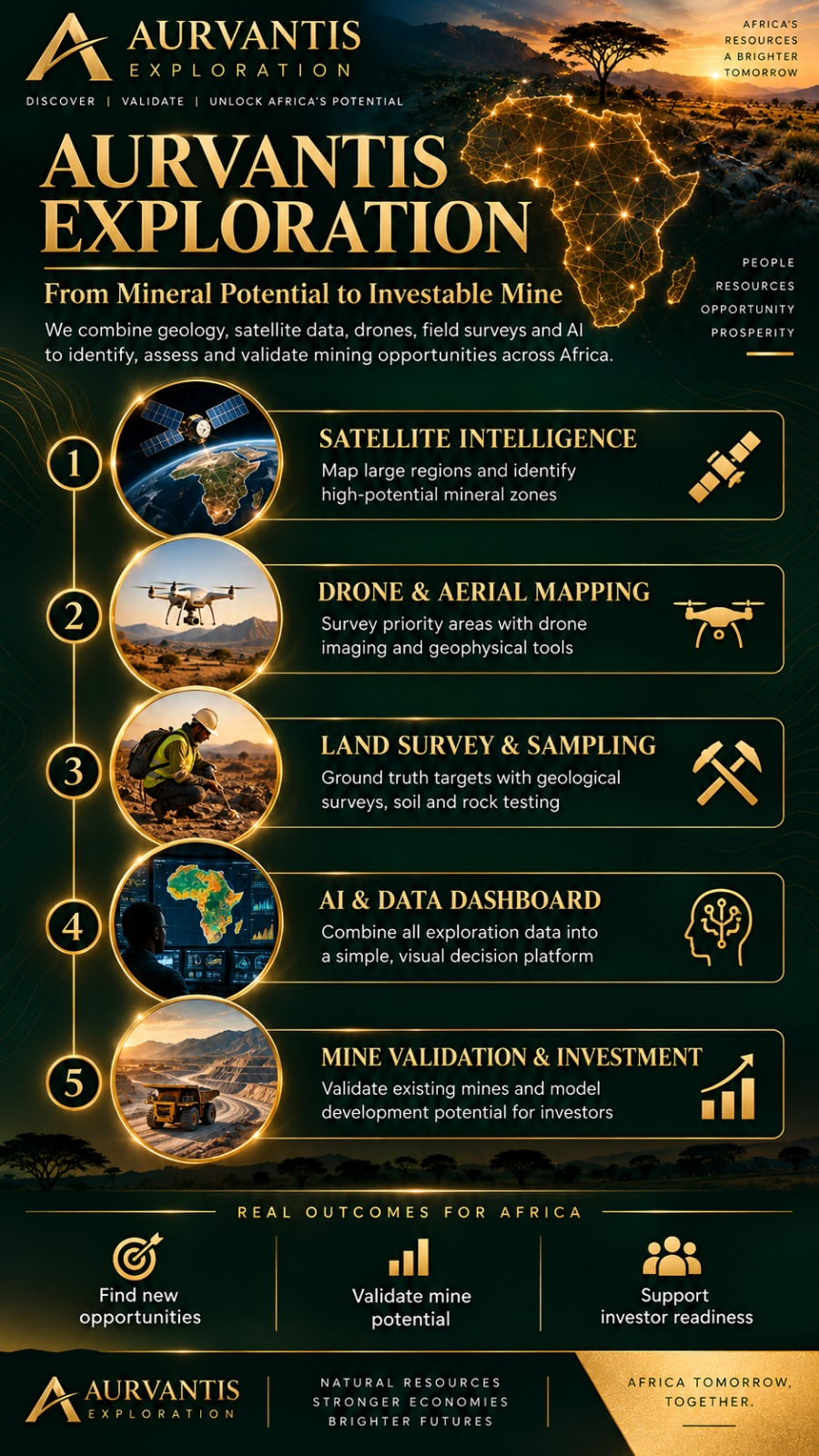
Aurvantis Exploration is a decision-support platform for mineral exploration and investment.
We bring together satellite intelligence, drone surveys, geology, geophysics, geochemistry, field evidence, historic mine information and financial modelling to answer three critical questions:
Instead of leaving governments, mine owners and investors to interpret disconnected reports, maps and datasets, Aurvantis turns exploration evidence into a clear, visual and commercially useful view of a mineral opportunity.
Explore. Validate. Model. Invest.
One decision platform
Whether the starting point is unknown land, partial evidence or an existing operation, Aurvantis creates a connected path from evidence to action.
The government or owner has land but limited evidence.
Where should we look first?
There is already evidence, but its strength and next step are unclear.
What does the evidence prove, what is missing and what should happen next?
An existing mine, historic mine, known deposit or partially developed project needs a clearer route forward.
What is required to validate, develop, expand or finance the opportunity?
The core workflow
Aurvantis sits above the specialist tools and services, turning their outputs into one coherent decision workflow.
Use geological knowledge, satellite intelligence and regional data to identify and rank promising areas.
Combine drone surveys, geophysics, sampling, assays, field observations and historic evidence to understand what is really known.
Identify uncertainty, missing evidence and the work most likely to increase confidence.
Connect geological assumptions with development cost, infrastructure, production, timing, risk and potential financial returns.
Turn the technical and commercial evidence into a clearer, structured, investor-ready opportunity.
“The objective is not simply to find mineral potential. It is to determine whether that potential can become a viable mine.”
The differentiator
Aurvantis should not just describe a project. It should help determine the next best action.
A project may not need another broad survey. It may need 50 soil samples, a targeted drone magnetic survey, 10 drill holes, metallurgical testing or independent assay validation. The platform helps identify the work most likely to create information gain.
For the people making the decision
Identify and prioritise mineral opportunities across regions, concessions or land portfolios.
Understand what evidence is missing and what is required to progress an opportunity.
Work from connected surveys, samples, assays, maps, reports and interpretations.
Examine geological confidence alongside development assumptions, financial scenarios, risk and funding requirements.
What the platform brings together
Rank land, prospects and targets.
Connect satellite, drone, geological, geophysical, geochemical and historic evidence.
Where should we look and where should we spend exploration money first?
How ready is this opportunity to move toward development and investment?
Connect geology with CAPEX, OPEX, production assumptions, timing and potential returns.
Move from a high-level conclusion down to the surveys, samples, assays, reports and interpretations supporting it.
Turn technical evidence into a structured development and funding proposition.
Evidence traceability
Every major score, conclusion and investment assumption should be traceable back to the evidence supporting it.
Survey → Sample → Assay → Report → Geological interpretation
Regional view → target → anomaly → sample → assay / observation
Our role
“We are not building another drone company, laboratory, geological consultancy or satellite business.”
Aurvantis is not selling satellite imagery, drone surveys or geological reports. We turn specialist outputs into investment decisions.
Go deeper
Open a section for the technical and commercial detail behind the decision platform.
Aurvantis does not attempt to replace specialist geological software, laboratories, satellite providers, drone operators or exploration consultants. We integrate the best available technologies and specialist services into one decision workflow.
The result is a simple visual interface over a much deeper evidence base. Aurvantis can remain asset-light by integrating specialist providers, APIs, laboratories, existing geological software, survey companies and modelling tools.
Aurvantis connects Region → Land Parcel → Licence → Prospect → Survey → Anomaly → Sample → Assay → Drill Hole → Geological Interpretation → Report → Development Assumption → Financial Scenario.
This is not simply a hierarchy. A sample can also connect to its exact location, geologist, laboratory, collection date, survey programme, assay result, anomaly, prospect, report and confidence level.
The purpose is to preserve relationships, evidence provenance, confidence, conflicting evidence and missing evidence in one connected evidence base, viewed at different levels.
For undeveloped land, Aurvantis progressively narrows the search area:
“Eliminate low-potential areas early and concentrate exploration capital where additional evidence is most valuable.”
High-resolution field evidence can be aggregated upward into higher-level intelligence without losing the original source data.
This score is for unknown or under-explored land. It can consider geological setting, structural geology, known mineral occurrences, satellite signatures, magnetic and geophysical anomalies, geochemical anomalies, historic workings, proximity to known mineralisation, evidence quality, accessibility and land or licence availability.
Primary question: Where should we investigate first?
It is a prioritisation tool, not certainty of mineralisation.
This score is for known deposits, prospects and existing mines. It can consider geological confidence, sampling, drilling, resource definition, metallurgy, infrastructure, production history, development requirements, permitting dependencies, environmental considerations, technical risk, commercial readiness, capital required and time to the next development stage.
The Mine Readiness Score supports decision-making. It does not replace formal resource reporting, feasibility studies, legal diligence, environmental review or independent technical assessment.
Mineral potential only creates value if it can become economically viable. Aurvantis connects geological evidence directly to financial assumptions.
Changes in grade, tonnage, recovery, production rate, infrastructure requirements, development schedule, CAPEX and OPEX should flow through into cash flow, funding requirement, payback, project value, investment return and scenario sensitivity.
The geological and financial views should evolve together. If geological confidence changes, the commercial model should be capable of changing with it.
Aurvantis Exploration can act as a technical opportunity-origination and validation capability supporting the wider Sovereign Investment & Development Fund strategy.
The relationship allows mineral opportunities to move from technical assessment toward credible investment propositions.
Purpose
We combine geological intelligence, modern exploration technologies, connected evidence and financial modelling to help decision-makers understand where the opportunity is, how strong the evidence is, what should happen next, what it will cost and whether the investment case makes sense.
Join Aurvantis Exploration
Aurvantis Exploration is currently in R&D and pilot development through 2026, with commercial launch planned for Q1 2027.
We are building relationships with geologists, remote-sensing specialists, drone and geophysical operators, laboratories, mining professionals, technology partners, governments, mine owners and investors.
“If you can help discover, validate, develop or fund the next generation of mineral opportunities, we want to hear from you.”